

Protecting our wetlands
Wetlands are the natural transition between land and water and are among the most important ecosystems in the Bay of Plenty. They include permanently or intermittently wet areas, shallow water, and water margins that support plants and animals adapted to wet conditions.
Wetlands are commonly found around lakes and rivers, but they also occur on low-lying flats, slopes and basins, and along estuary margins where they may be influenced by tides. Wetlands may be referred to as bogs, fens, swamps or marshes, reflecting different wetland types.
No two wetlands are the same. Their size, structure and ecological values vary depending on factors such as:
- soils
- topography
- climate
- hydrology
- water chemistry
- vegetation
- human activity
Wetlands can also change over time as environmental conditions shift.
Why wetlands are under threat
Wetlands are highly sensitive to changes in climate, water availability, land use and disturbance, making them particularly vulnerable to human activities.
Around 90 percent of New Zealand’s freshwater wetlands — including those in the Bay of Plenty — have been lost in the past 150 years. Most losses occurred in areas well suited to farming and development. Draining, burning and clearing vegetation for agriculture, along with reclamation for urban and industrial use, have been the main causes of wetland loss.
What’s threatening our wetlands
Activities that can reduce the health, function and values of wetlands include:
- inappropriate land use and development
- drainage or infilling to create productive land
- grazing, pugging and wallowing by stock
- construction of structures
- lack of ongoing management and maintenance
- pest animals and invasive plants, such as parrot feather
- burning of vegetation
- discharges of contaminants, including nutrients and sediment from land use activities
Finding wetlands
To explore wetlands in the Bay of Plenty region, check out the Wetlands map layer (under Environment).
Many of these wetlands provide important habitats for freshwater-dependant threatened species, conservation species and indigenous fish. You can view these indicative freshwater habitat locations using the layers under Freshwater Habitats.
Some wetlands are also identified as Priority Biodiversity Sites.
What the regulations require
National wetland regulations are designed to prevent further loss of wetlands and associated ecosystems by restricting damaging activities in and near natural wetlands. The Regional Natural Resources Plan, Tarawera River Catchment Regional Plan and the Regional Coastal Environment Plan also contain relevant policies and rules. Generally national wetland and stock exclusion regulations will override existing Regional Plan rules, and in any case, the more stringent applies. National regulations require cattle, deer and pigs, to be kept out of natural wetlands, and control what work can be done in and around natural inland wetlands. Many activities now need a resource consent.
The work you can do in, and around natural inland wetlands depends on its type, purpose, and impact. NESF clauses 37 – 56 regulate activities that may take place within or near natural inland wetlands, including:
- Earthworks / land disturbance
- Removing vegetation
- Taking, using, damming, diverting, discharging water.
The Stock Exclusion regulations require that all cattle, deer and pigs must be excluded from:
- natural wetlands identified in an operative regional plan, district plan, or regional policy statement by 1 July 2023; and
- natural wetlands that support a population of threatened species, by 1 July 2025.
You can check whether a wetland in or near your property supports populations of freshwater fish, conservation species or threatened species by turning on the Wetlands layer (under Environment) and also the relevant Freshwater Habitats map layers.
How you can help protect and restore wetlands
You can play an important role in protecting wetlands by:
- fencing wetlands on your property and encouraging others to do the same
- avoiding drainage works in and near wetlands
- getting involved with a local care group
- legally protecting wetlands, for example through a QEII National Trust covenant
- actively managing wetlands by controlling pest plants and animals
How we can help
Our Land Management Officers work with landowners and communities to protect, restore and enhance wetlands. We can provide advice and support on:
- Environmental Enhancement Fund project funding
- resource consent requirements
- Environmental Programme Agreement funding for wetlands on private land
- wetland creation, restoration and enhancement, including design, planting, fencing, maintenance and long-term management
- legal protection options, such as QEII National Trust covenants
- connecting with existing wetland care groups
We also recommend the Bay of Plenty Wetland Restoration Guide prepared by the Bay of Plenty Wetlands Forum, which includes the Department of Conservation, Bay of Plenty Regional Council and Fish & Game New Zealand.
Our Duty Consents Officers are also here to help you navigate our Regional Plans and National Environmental Standards find the relevant rules. Have a look at the Resource Consents pages. When you’re ready, call 0800 884 880 or email consents.queries@boprc.govt.nz to arrange a meeting with our Duty Consents Officer.
Our latest wetland projects
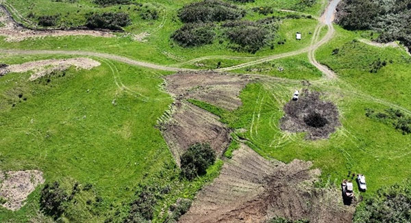
EASTERN BAY OF PLENTY
Te Pourepo o Kaituna wetland
The Whakatāne-Ōhope Environmental Programme aims to restore and improve five sites for form a broken sequence of indigenous forest corridor that extend from the coast inland to Te Urewera and are home to a number of threatened floral and fauna.
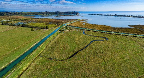
WESTERN BAY OF PLENTY
Cutwater Road Wetland
Cutwater Road wetland sits on the margins of the Waihī Estuary, between the Pongakawa River and Pukehina Canal. Together with iwi collective Te Wahapu o Waihī, we are working to transform 30ha of farmland into a wetland to help improve the estuary’s health.
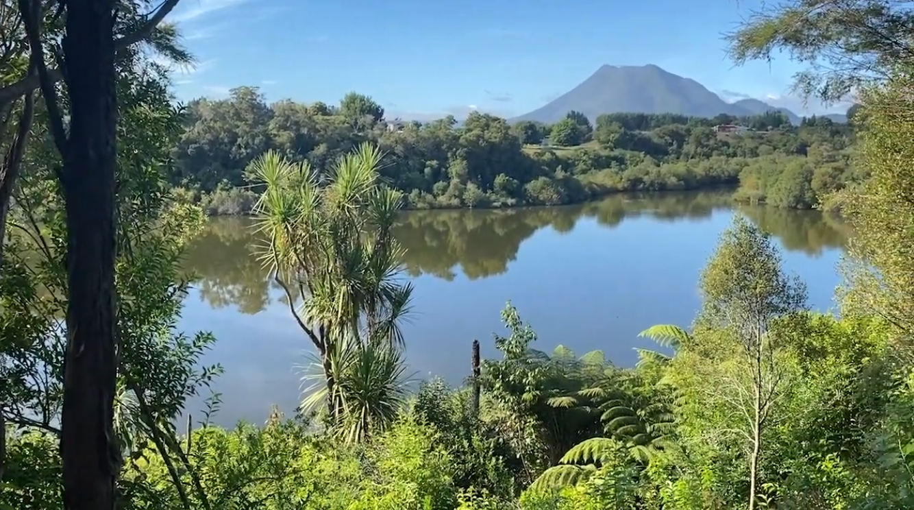
ROTORUA LAKES
Winiata Wetland
Winiata Wetland sits roughly 10km south of Rotorua at the top of the Puarenga catchment. This wetland design seeks to optimise nitrogen-removal from the local catchment as well as improve biodiversity in the area.