Coastal inundation occurs when low-lying coastal areas are flooded by rising sea levels. This is more likely during high tides, storms, and when waves are particularly strong.
Areas that flood occasionally now may experience more frequent flooding in the future due to our changing climate. Natural buffers like sand dunes play a crucial role in helping coastlines recover after storms. Through Coast Care, a coastal restoration program in partnership with local communities, local authorities, and schools, we’re working to restore and protect sand dunes along Bay of Plenty beaches.
Coastal inundation maps
New coastal inundation maps will be available on our BayHazards viewer in mid 2026. These maps will be based on expert modelling by Earth Sciences New Zealand and will show areas that could be affected by this hazard over the next 100 years, as the climate changes.
Although the maps will show future scenarios, as a community it's important to start planning now to ensure new development is resilient and long-term risks are managed. Emergency Management Bay of Plenty also uses these maps to help keep the public informed and prepared for these hazards.
The coastal inundation maps will illustrate areas along the coast likely to be affected by this hazard during an extreme event based on various time and sea level rise scenarios.
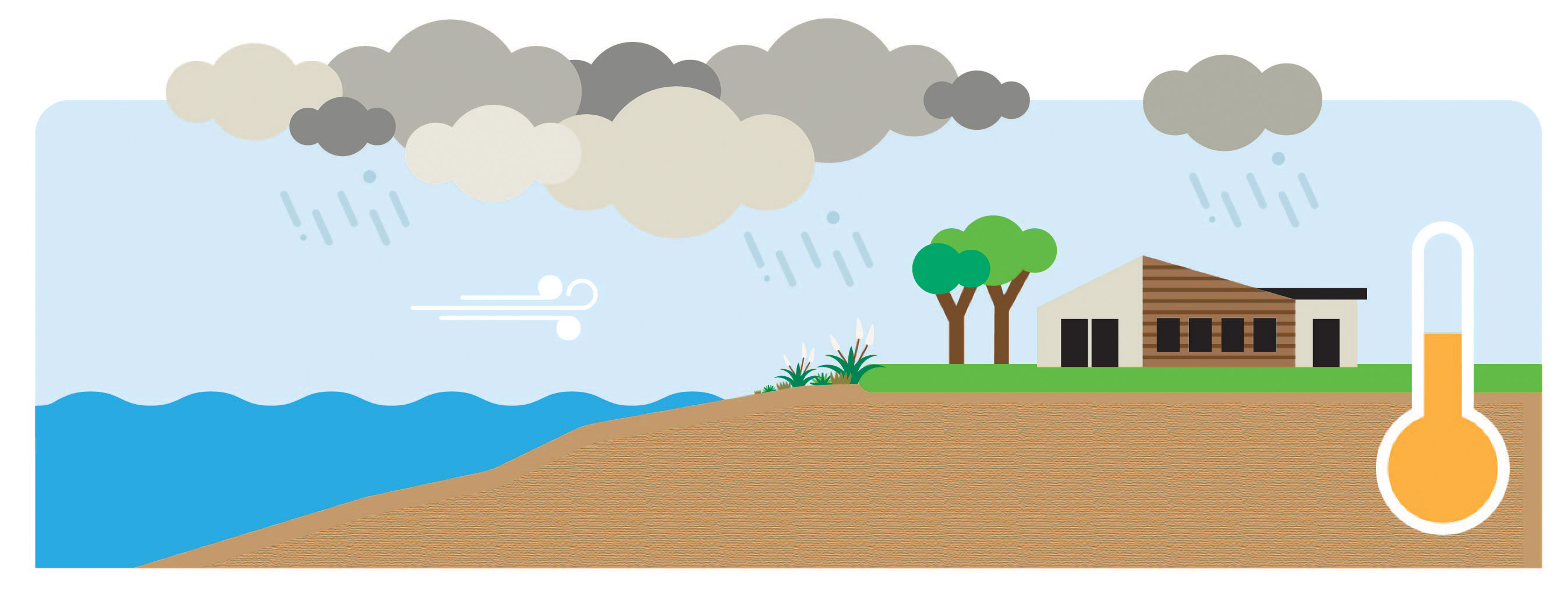
Current climate
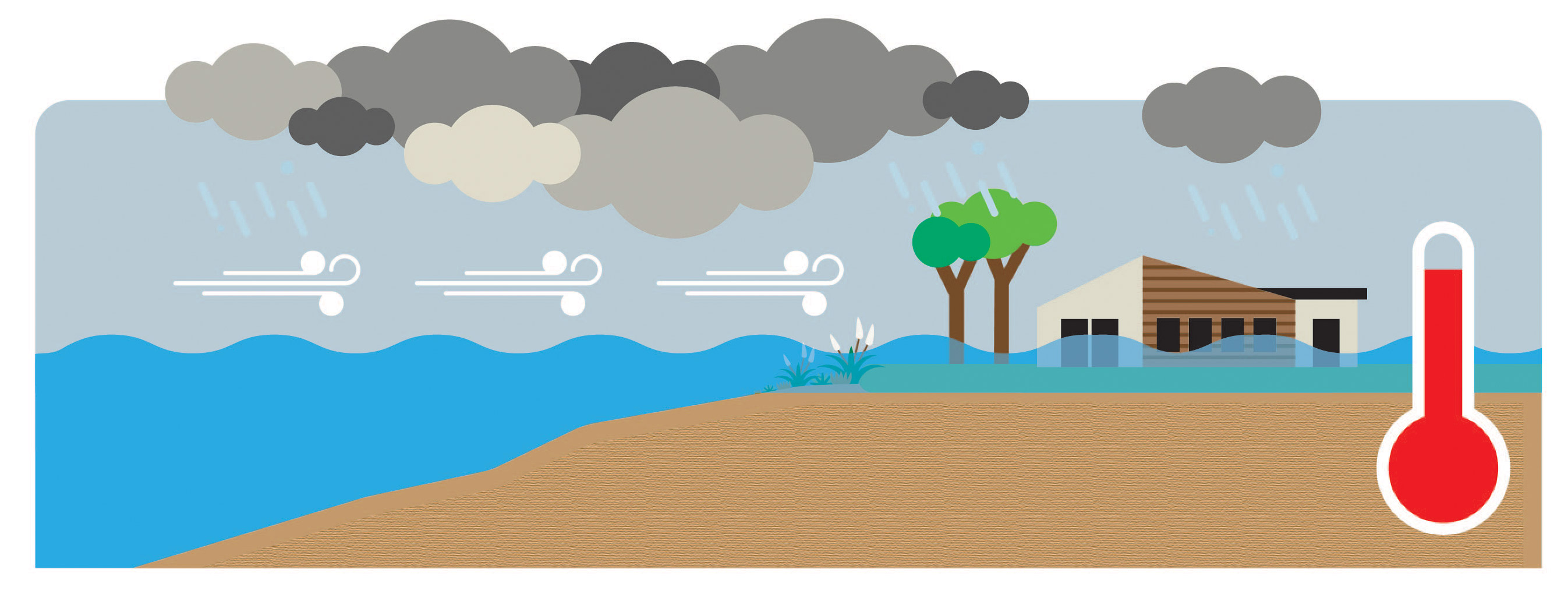
Future Climate: flooding due to coastal inundation - rising sea levels as well as storm surge
Regional Council has requested these maps to ensure the community has access to the best and most accurate information. It is also a legislative requirement by the Resource Management Act (RMA) that we identify natural hazard areas in our region.
The interactive maps will be able on our BayHazards viewer in mid 2026. When live, you will be able to search by property to see what hazards may apply.
The coastal flooding information and maps will be used in the following council processes:
To improve understanding around the effects of this natural hazard to support future land-use and urban growth planning.
To inform both current and future infrastructure projects, including upgrades to existing assets and assessing long-term effects on infrastructure performance and resilience.
To inform the building consent process and applications for new building consents.
To evaluate applications for new subdivisions with regard to coastal flooding risks.
Land information memoranda (LIM) held by relevant local councils.
Projected coastal inundation was mapped over three different time periods at the current climate and future climate in 50 and 100 years’ time. BayHazard will show two scenario, current day and future (100 years), as required for RMA planning and Building Act requirements.
The future climate scenarios are based on future greenhouse gas emission scenarios (known as Representative Concentration Pathways or RCPs). These range from where a medium global effort is made to reduce carbon emissions (RCP 4.5) to where a minimal global effort is made to reduce carbon emissions (RCP 8.5).
For example, will we continue to burn fossil fuels at an ever-increasing rate, or will we shift towards renewable energy? The RCPs try to capture these future trends. They make predictions of how concentrations of greenhouse gases in the atmosphere will change in future as a result of human activities.
Natural hazards are also mapped for a range of likelihood scenarios, which is the chance of the hazard occurring in any one year. The likelihood scenarios are a requirement of the Bay of Plenty Regional Policy Statement and change for each hazard.
The coastal inundation modelling was done by Earth Sciences New Zealand who used a hydrodynamic mapping methodology that is much more accurate than the previously used bathtub mapping method. This new methodology is not used widely elsewhere in Aotearoa, making Toi Moana a leader in this space.
Property values are usually influenced by a range of factors, including the state of the economy, interest rates, income levels, and population changes. While many New Zealanders enjoy living near the coast, it’s possible at some point that some coastal properties at risk of natural hazards may no longer become as desirable.
When it comes to insurance, the Council cannot provide advice on how this mapped information may affect insurance premiums or a property owners ability to obtain insurance. We recommend contacting your insurance provider directly to discuss your specific policy.
In general, individual contracts are reviewed annually and are based on current risk. Therefore, the coastal erosion maps that model changes over 50 and 100 year timeframes should not be used to analyse short term risk for insurance purposes.
Deep South National Science Challenge has developed an easy-to-read information sheet for homeowners, with important frequently asked questions about how insurance companies might respond to increasing climate hazards. Read more about house insurance and climate change.